
Sanborn Fire Insurance Map of Trent Alley, 1950
Title
Sanborn Fire Insurance Map of Trent Alley, 1950
Description
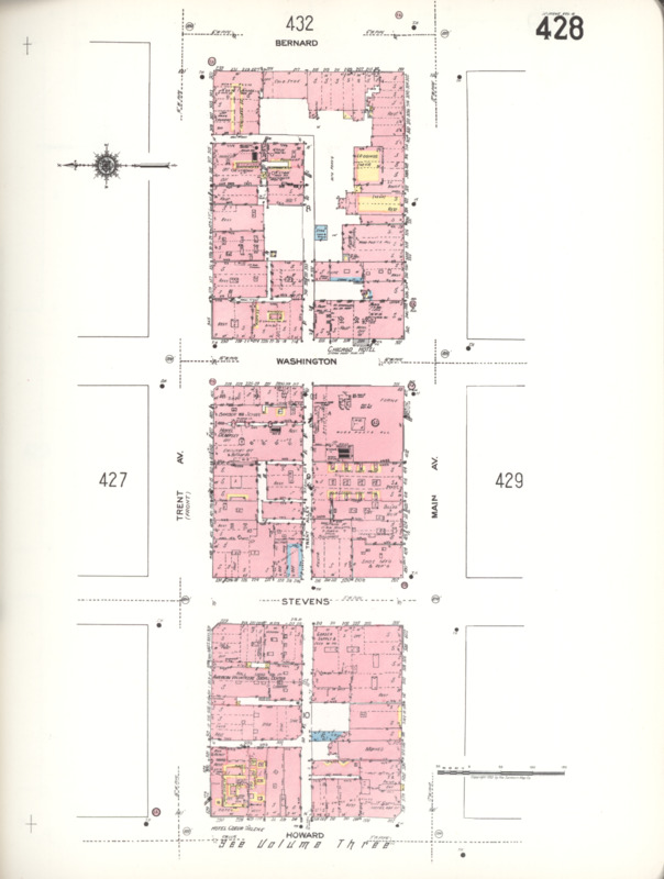
Trent Alley is typically associated with three blocks between Trent Avenue (now Spokane Falls Boulevard) and Main Avenue. This map depicts those blocks with the eastern edge at the top of the map. The eastern-most block, where Trent Alley forms an "L" shape, is the current site of the Davenport Grand.
Creator
Sanborn Map Company
Source
Library of Congress Geography and Map Division: https://www.loc.gov/item/sanborn09331_015
Date
1950
Format
Fire insurance maps
Collection
Citation
Sanborn Map Company, “Sanborn Fire Insurance Map of Trent Alley, 1950,” Spokane Public Library, accessed July 22, 2026, https://lange.spokanelibrary.org/items/show/5851.