
Browse Items (5932 total)
Sort by:
Northwest -- Idaho -- Post Falls (#08)

Two women and a man on rocks at "the flume at Post Falls, Idaho."
Northwest -- Idaho -- Murray (#02)

"View of the valley of the Prichard Creek showing the town of Murray in the distance and the Auror road in the foreground."
Northwest -- Idaho -- Mullan Tree (#02)

"Condition of the blaze placed on the pine tree July 4, 1861 as of about 1940 in what is now known as 4th of July Canyon."
Northwest -- Idaho -- Mullan Tree (#01)
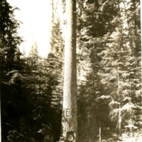
Mullan Tree in 4th of July Canyon before protecting steel fence was built around it.
Northwest -- Idaho -- Moscow (#01)

"Here we get a fine view from the air of the City of Moscow, Idaho, with the State University in the foreground."
Northwest -- Idaho -- Lookout Pass (#01)
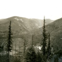
"The Coeur d'Alene mountains at the Lookout Pass above Mullan, Idaho"
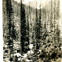


Northwest -- Idaho -- Lewiston (#18)

"Waterfront at Lewiston, situated at confluence of Snake and Clearwater Rivers"

Northwest -- Idaho -- Lewiston (#10)

"Clearwater Timber Company, now Potlatch Forest Industries. Lewiston, Idaho"
Northwest -- Idaho -- Lewiston (#09)

"The biggest little city in the West, Lewiston, Idaho. Here we see the business section and get the excellent view of Normal Hill, the residential portion of the city."

Northwest -- Idaho -- Lewiston (#07)

"A checkerboard view of Lewiston (Idaho). Orchards, showing one of the two reservoirs serving the district."

Northwest -- Idaho -- Lewiston (#05)

The Luna House. Originally a hotel, the building served as the county courthouse from 1882 to 1889. The building was razed prior to January 1891.
Northwest -- Idaho -- Lapwai (#04)

"View of the town of Lapwai and Indian Agency buildings, the latter being in the foreground of the view"
Northwest -- Idaho -- Elk River (#01)

Aerial view of Elk RIver, Idaho. Gold Creek in background. Taken before 1950.
Northwest -- Idaho -- Eagle City (#01)

"Matheny and Johnson Placer showing town of Eagle with a view of Pritchard Creek"

Northwest -- Idaho -- Burke (#05)

The night shift of the Tiger mine poses for a photograph. Date unknown.

Northwest -- Highways -- Washington (#11)

"Highway northward through the Grand Coulee, Washington, toward the north end of the Coulee"
Northwest -- Geology -- Washington (#10)
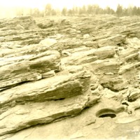
"Showing the Kettles holes in the bedrock worn by the cutting effect of the Columbia River current at Kettle Falls"
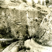


Northwest -- Geology -- Washington (#05)

"Glacial erosion;; action of the Spokane glaciation in the Upper Flathead Valley"
Northwest -- Geology -- Washington (#04)

"Glacial erosion action of Spokane glaciation in Upper Flathead Valley"
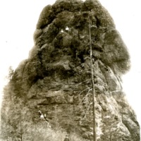
Northwest -- Forts and blockhouses -- Washington -- Fort Walla Walla (#24)

"Site of Ft. Walla Walla. Columbia River just below juncture of Walla Walla River and Columbia - showing 'Twin Sister' rocks."
Northwest -- Forts and blockhouses -- Washington -- Fort Walla Walla (#21)

"A view of the site and physical surroundings of the old HBC post as the locality appeared about 1921."
Northwest -- Forts and blockhouses -- Washington -- Fort Walla Walla (#20)

Two women and a boy at the site of Fort Walla Walla on the Columbia.
Northwest -- Forts and blockhouses -- Washington -- Fort Walla Walla (#18)

Site of Fort Walla Walla on the Columbia River
Northwest -- Forts and blockhouses -- Washington -- Fort Walla Walla (#17)

Site of Fort Walla Walla on the Columbia River
Northwest -- Forts and blockhouses -- Washington -- Fort Walla Walla (#16)

Site of Fort Walla Walla on the Columbia River
Northwest -- Forts and blockhouses -- Washington -- Fort Walla Walla (#15)

"A view of the site and physical surroundings of the old HBC post as the locality appeared about 1921."
Northwest -- Forts and blockhouses -- Washington -- Fort Walla Walla (#09)

Site of Fort Walla Walla on the Columbia River