
Browse Items (5932 total)
Sort by:
Spokane River (Folder 1, #38)

"Junction of the Spokane River and the Little Spokane as seen from hills to the north. Shows the point of junction open and free from trees in the foreground."
Spokane River (Folder 2, #20)

"Reflections on the stream just below the debouchment of Deep Creek Canyon. Original negative made in September 1938." Bromide enlargement
Spokane River (Folder 2, #30)

"Looking down the course of the Spokane River just before the junction with the Little Spokane. Taken from the hilltop." Spring 1935.
Spokane -- Views (Folder 1, #13)

"Cloud bank October 24, 1936. Looking North from Lewis and Clark High School."
Spokane -- Views (Folder 1, #37)

"Looking north and east from Cliff Drive above the Finucane home on 8th and Washington."

Spokane -- Views (Folder 1, #40)

"Looking across the business section of the city from between 2 pines. Near 6th and Jefferson. Looking northeast."
Spokane -- Views (Folder 2, #26)

Cloud bank of Saturday afternoon, October 24, 1936. Looking west from Lewis and Clark High School.

Spokane -- Views (Folder 3, #01)

Looking from Cliff Drive at junction of Washington and Cliff between two tall pines with Paulsen Medical and Dental and Old National Bank buildings as chief motif in the scene.
Spokane -- Views (Folder 3, #35)

"Spokane as seen under the cloud mantle of the past Saturday afternoon, October 24th." Taken from Lewis and Clark High School.
Spokane County -- Hangman Valley (#01)

"Looking southward up Hangman Valley and across the Stafford Addition from the end of 9th Avenue"
Spokane County -- Hangman Valley (#02)

"Looking northward down the valley and across the Sixth Avenue bridge from the High Drive parkway near the Washington Water Power Company's substation."
Spokane County -- Hangman Valley (#03)

"Looking northward down the valley from between two large pine trees and from near the Washington Water Power Company substation at 27th Avenue."
Spokane County -- Hangman Valley (#04)

"Looking southward up the valley from High Drive parkway. To the left is Browne's Butte. Inland Empire Highway follows valley"
Spokane County -- Marshall Canyon (#01)
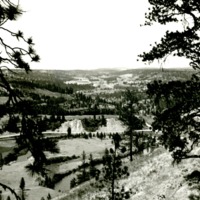
"Looking southwestward up the canyon from High Drive, Spokane."
Northwest -- Battlefields -- Wright Campaign (#11)

"The rock to the northwest of Fort George G. Wright which it had been proposed the United States Board of Geographic Names should name "Kamiakin's Crag" in honor of the notable Yakima Indian leader of the eighteen-fifties. It was at this point that…
Northwest -- Battlefields -- Wright Campaign (#12)

Monument commemorating the battle of Four Lakes fought in 1858.
Northwest -- Battlefields -- Wright Campaign (#14)

Front view of the marker placed to commemorate the battle of Four Lakes.
Northwest -- Canyons -- Deep Creek (#02)

"Viewed from east rim of Deep Creek Canyon about 3PM, March 28, 1937"


Northwest -- Canyons -- Deep Creek (#13)

"Example of differential weathering along the banks of the Spokane just east of the mouth of the Canyon"
Northwest -- Canyons -- Deep Creek (#14)

"One of the rock pinnacles showing effect of differential weathering within the mid section of the canyon."
Northwest -- Canyons -- Deep Creek (#17)

"Cheese-box like formation at foot of canyon and rising from east rim."
Northwest -- Canyons -- Deep Creek (#21)

"Isolated needle of lava rock jutting up from west rim of canyon."
Northwest -- Canyons -- Deep Creek (#24)

"Full view of the canyon showing both banks but taken to show the "pillow" lava formations on the east bank."
Northwest -- Canyons -- Deep Creek (#25)

"Close-up of the pillow formation of lava on the east bank of the canyon."
Northwest -- Caves (#02)

"Gardner Caves, Stevens County, Washington. Interior view showing the formations together with Mr. McMacken, Lewis and Clark High School"
Northwest -- Forts and blockhouses -- Idaho -- Fort Sherman (#10)

Commanding officer's home as seen from the lake shore to the southeast of the house.
Northwest -- Forts and blockhouses -- Idaho -- Fort Sherman (#11)

Officer's quarters at Fort Sherman

Northwest -- Forts and blockhouses -- Washington -- Fort Colville (#01)

"Site of the location of the old Hudson's Bay post as it appeared in 1930. Crumbled rocks of the foundation plainly seen."
Northwest -- Forts and blockhouses -- Washington -- Fort Colville (#02)

"Tree standing on the site of the old Hudson's Bay post - site as it appeared in 1930"
Northwest -- Forts and blockhouses -- Washington -- Fort Colville (#03)

"Looking northeasterly across the site of the old Hudson's Bay post as that site appeared in 1930"
Northwest -- Lakes -- Bonnie Lake (#01)

"Looking northeastward up the coulee with the slender tip of Bonnie Lake showing against the left wall of the coulee in the middle ground."
Northwest -- Lakes -- Bonnie Lake (#02)

"Looking southward down the coulee from the southern tip of Bonnie Lake with grain field occupying the bed of the coulee."
Northwest -- Lakes -- Bonnie Lake (#03)

"looking northward up the course of the lake with the vertical west wall occupying the left field of the picture."
Northwest -- Lakes -- Bonnie Lake (#06)

"Shows the vertical west wall of the coulee to the right of the southern tip of Bonnie Lake."
Northwest -- Lakes -- Bonnie Lake (#07)

"Looking southward along the surface of the lake from the edge of the water level. Vertical walls of the coulee very well shown."