
Browse Items (5932 total)
Sort by:
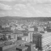
Spokane -- Views (Folder 2, #11)

Looking north across city. Streets in foreground are McClellan and Browne.
Spokane -- Bridges, Third Monroe Street (#25)

Another view of the third Monroe Street bridge, Lower Fall and Washington Water Power Company powerhouse illuminated at night. Taken facing upstream. Date unknown.
Spokane -- Bridges, Third Monroe Street (#24)

The third Monroe Street bridge, Lower Fall and Washington Water Power Company powerhouse illuminated at night. Taken facing upstream. Date unknown.
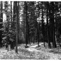
Northwest -- Roads and Trails (#16)
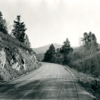
"Wallace - Kellogg - Mullan Road east of Cataldo Mission, 1926."
Spokane -- Streets -- Riverside (#22)

Riverside Ave. as seen from Civic Bldg, a.k.a. Chamber of Commerce.


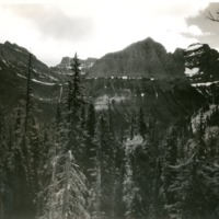
Northwest -- National Parks and Reserves -- Glacier (#06)

"Lake St. Mary's in distance from Logan Pass"

Northwest -- Lakes -- Coeur d'Alene (#19)

Clyde Stricker, water ski expert at Coeur d'Alene, Lake, Idaho.
Northwest -- Idaho -- Lookout Pass (#01)
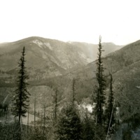
"The Coeur d'Alene mountains at the Lookout Pass above Mullan, Idaho"


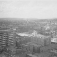
Spokane -- Views -- Aerial (#20)

Taken north and west of downtown Spokane. Cement plant on Government Way visible in foreground. Natatorium Park visible across river to the left. Summit Blvd. located above the bluff. Cluster of buildings to the right of photo on Summit blvd. is St.…
Spokane -- Views -- Aerial (#05)

View of High Bridge (Union Pacific Railroad bridge) crossing Latah Creek and the Spokane River. White building just above Monroe Street Bridge is Montgomery Wards store and later City Hall. Taken from point just west of town faceing east.

Northwest -- Idaho -- Elk River (#01)

Aerial view of Elk RIver, Idaho. Gold Creek in background. Taken before 1950.
Engineer's Town - Coulee Dam - Mason City in background.
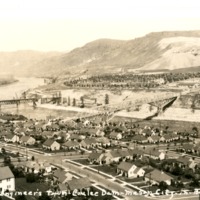
"Looking down upon the city from the hill directly above."
Coulee Dam - Engineer's Town - Mason City background.
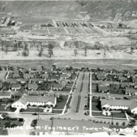
Coulee Dam - Engineer's Town - Mason City background.
Spokane -- Bridges, Third Monroe Street (#06)

The third Monroe Street bridge during the early 1910s. Advertising for Rantz and Halstead and beer visible in the background. Before 1914.
Spokane -- Bridges, High (#02)

The Union Pacific/Milwaukee Road high bridge across the Spokane River and Latah Creek under construction in 1913.
Spokane -- Bridges, High (#03)

Workers on the Union Pacific/Milwaukee high bridge across the Spokane River. Taken facing northwest.
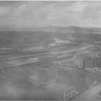
Northwest -- Railroads (#03)

American R.R. Ditcher working at the entrance to a tunnel on the the Spokane International (SI) Railway. Taken east of Bonners Ferry, July 1918. H.B. Burnett is the operator and Ted Johnson is the fireman.
Spokane Valley -- Homes -- Bergman (#01)

Interior of Bergman home at 11204 E. Sprague. Home built by Charles B. Bergman, who owned the Siberian Arctic Fur Manufacturing Company of Spokane. The home was a showplace in the Valley with a sunken garden and extensive landscaping. It was…
Northwest -- Rivers -- Columbia (#16)
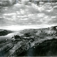
"Gorge of the Columbia looking east from the Vista House on the south bank"
Northwest -- Rivers -- Columbia (#10)
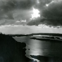
Looking down on the Columbia River from Crown Point at sunset.


Indians -- Portraits (#12)

"Oregon's Indian Madonna." Unidentified woman and baby, taken at The Dalles.
