
Browse Items (104 total)
- Collection: Spokane Views
Sort by:


Spokane -- Spokane Falls (town) (#15)

Spokane Falls, Wash. Looking across the site now occupied by the Paulsen Building. Taken just before the fire in 1889.


Spokane -- Views (Folder 1, #22)

"Night view of the business section looking north. Taken from about the 600 block on West Cliff avenue, 9 p.m." (undated)
Spokane -- Views (Folder 1, #42)

"Night view of the business section from the north end of the Division Street Bridge. Taken while raining."

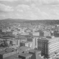
Spokane -- Views -- Aerial (#09)

Buisness section of Spokane taken from above the Paulsen Building. Note Airport sign on Old Nat'l Bank bldg.

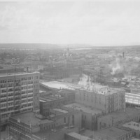
Spokane -- Views -- Aerial (#05)

View of High Bridge (Union Pacific Railroad bridge) crossing Latah Creek and the Spokane River. White building just above Monroe Street Bridge is Montgomery Wards store and later City Hall. Taken from point just west of town faceing east.
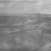
Spokane -- Views -- Aerial (#20)

Taken north and west of downtown Spokane. Cement plant on Government Way visible in foreground. Natatorium Park visible across river to the left. Summit Blvd. located above the bluff. Cluster of buildings to the right of photo on Summit blvd. is St.…
Spokane -- Views (Folder 2, #11)

Looking north across city. Streets in foreground are McClellan and Browne.


Spokane -- Views (Folder 2, #25)

"Looking north across the business section of the city. Street in middle is Stevens taken from Cliff Park."
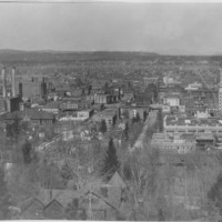
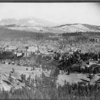
Spokane -- Views (Folder 3, #18)

"Spokane, Wash. from the Hillside." "Looking northwest across the city to and beyond Fort Wright from Cliff Drive. 1910 or earlier. D. C. Corbin home in foreground."
Spokane -- Views (Folder 3, #28)

View across the Monroe Street Bridge before the courthouse was built.
Birdâs-eye view of the business section of Spokane

Birdâs eve view of the business section of Spokane. Some of the buildings are identified.


Spokane -- Views (Folder 2, #41)

Looking up the river and across the city from Riverside Park Cemetery
Spokane -- Views (Folder 3, #55)
Looking east over Boone, Gardner Dean St. (left to right) and Summit Blvd. (in foreground)
Spokane -- Views (Folder 2, #33)

"Panoramic view of the city from above Judge George Turner's home looking to west of north"
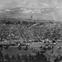
Spokane -- Views (Folder 1, #45)

"Looking at Summit Blvd. on north side of Spokane. Looking east across the city and to the snow-capped Coeur d'Alenes in the distant background."

Spokane -- Views (Folder 3, #40)

Looking north across the city from a point immediately above the Judge Turner residence on 7th Avenue. Between Howard and Stevens running north.
Spokane -- Views (Folder 2, #08)

Auditorium building. City Hall in background. Looking northeast from Lincoln and Main.