
Browse Items (569 total)
- Collection: Scenic Northwest
Sort by:
Spokane County -- Hangman Valley (#03)

"Looking northward down the valley from between two large pine trees and from near the Washington Water Power Company substation at 27th Avenue."
Spokane County -- Hangman Valley (#04)

"Looking southward up the valley from High Drive parkway. To the left is Browne's Butte. Inland Empire Highway follows valley"
Spokane County -- Marshall Canyon (#01)
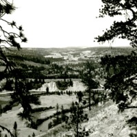
"Looking southwestward up the canyon from High Drive, Spokane."


Washington -- Dry Falls (#02)
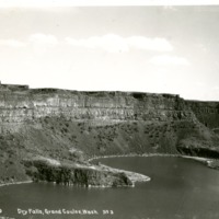
Dry Falls, Grand Coulee, Wash. The falls seen from the present position of the Vista House.


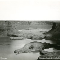

Washington -- Grand Coulee (#01)

"Close-in of the granite rock formations at the head of the Coulee a short distance from the Columbia. Photograph by the Inland Automobile Association, Spokane."


Washington -- Grand Coulee (#08)

"General view from the east of the Grand Coulee over the field of granite near rocks the north beginning of the Coulee"

Washington -- Grand Coulee (#10)

"Road northward following closely the east rim of the Grand Coulee from Coulee City to the Coulee beginning at the Columbia"
Washington -- Grand Coulee (#11)

"Lover's Lane, the improved highway as it makes its way through the granitic formation near the north end of the Coulee"
Washington -- Grand Coulee (#12)

North end of the Grand Coulee. The highway and the high basaltic rock walls of the east line of the coulee near the north end.


Washington -- Grand Coulee (#20)

"Northrup Canyon. View of the Coulee from Inspiration Point on the east rim"


Washington -- Grand Coulee (#24)

"North end, Grand Coulee, Wash. The granitic rock formations near the north end of the Coulee as viewed from the highway some distance to the south."
Washington -- Grand Coulee (#25)

"Grand Coulee, Wash. View of the strangely weathered rock formations of the lower coulee."


